Discover Julian Alps trough diffrent guided tours
Triglav is not just a mountain; it is the patriarch. The highest peak of Slovenia, boasting its impressive height of 2864 meters, stands as a symbol. A symbol of Slovenianness, a symbol of the Slovenian nation, and it's almost a sin if you don't stand on it to feel that pride or at least the greatness over everything beneath you.
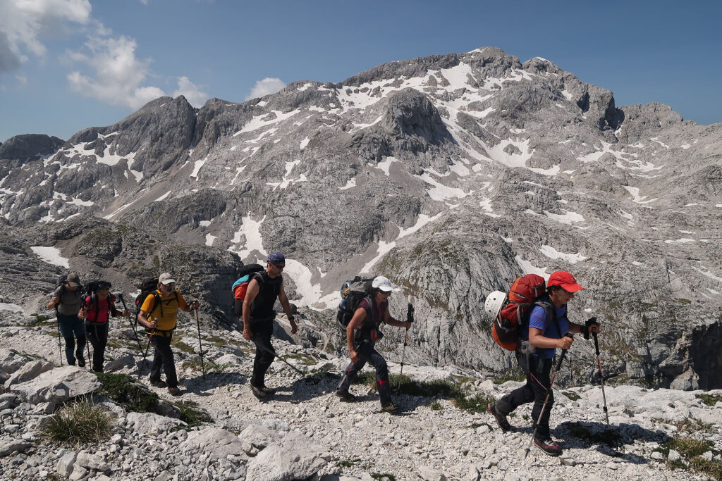
It was conquered as far back as 1778 by four brave men, a full eight years before Mont Blanc. They set off from Lake Bohinj, which you can see as clear as day. The longest route to it, however, is not the only one. You can climb Triglav also from Pokljuka, where you need to overcome a smaller altitude difference, from Mojstrana, which is also the most popular starting point, as three valleys lead to its base: Krma, Kot, and Vrata, above which rises the mighty North Face of Triglav. The last starting point is from the village of Trenta, where the trail leads through the Zadnjica valley. If you're short on time and want to climb more quickly in two days or even one, this is an excellent choice. But if you crave a true adventure and want to explore the Julian Alps, most of which lie within the Triglav National Park, the only national park of its kind in Slovenia, a multi-day trek will be the perfect choice.

Triglav tekking traverse
1. DAY
Dom Klementa Juga in Lepena 700 m – Dom pri Krnskih jezerih 1385 m – Krn 2245 m – Batognica 2164 m – below the summit above Peski 2100 m – Prehodci Pass 1639m – Za Lepočami 1630 m – Bogatinsko saddle 1804 m – Dom na Komni 1520 m.
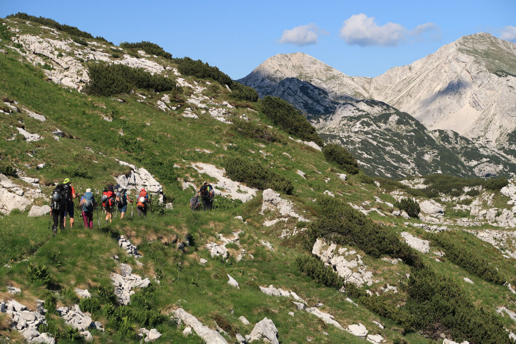
The four-day journey through the Julian Alps begins at the Klement Jug Mountain Hut in Lepena. We continue past the Krn Lakes all the way to Mount Krn. Then, a diverse and historically rich trail awaits us to Batognica, Prehodci Pass, and finally to the Dom na Komni mountain hut. There, we indulge in a well-deserved rest and a delicious dinner.
- Starting altitude: 700 m
- Highest point: 2245 m
- Destination altitude: 1520 m
- Altitude difference: 1845 m
- Length: 25 km
- Time: 10-13 h.
2. DAY
Dom na Komni 1520 m – Lopučnica Valley 1550 m – Koča pri Triglavskih jezerih 1685 m – Hribarice 2358 m – Koča na Doliču 2151 m.
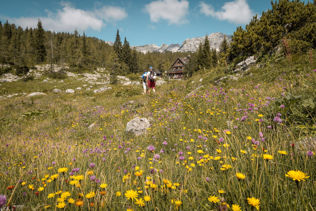
This day will surprise us with the beauties of the longest high-altitude valley in the Julian Alps. The trail from Dom na Komni follows the path of the Triglavski smučarski magistrala. Through the valley, we will have breathtaking views of all seven lakes in the valley. Stops at mountain huts will lead us to Koča na Doliču.
- Starting altitude: 1520 m
- Highest point: 2385 m
- Destination altitude: 2151 m
- Altitude difference: 965 m
- Length: 18 km
- Time: 9-10 h.
3. DAY
Koča na Doliču 2151 m – Triglav 2864 m – Dom Planika 2401 m – Konjsko sedlo 2020 m – Vodnikov dom 1817 m.
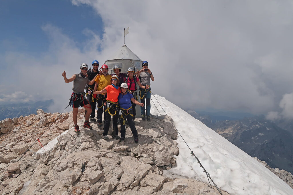
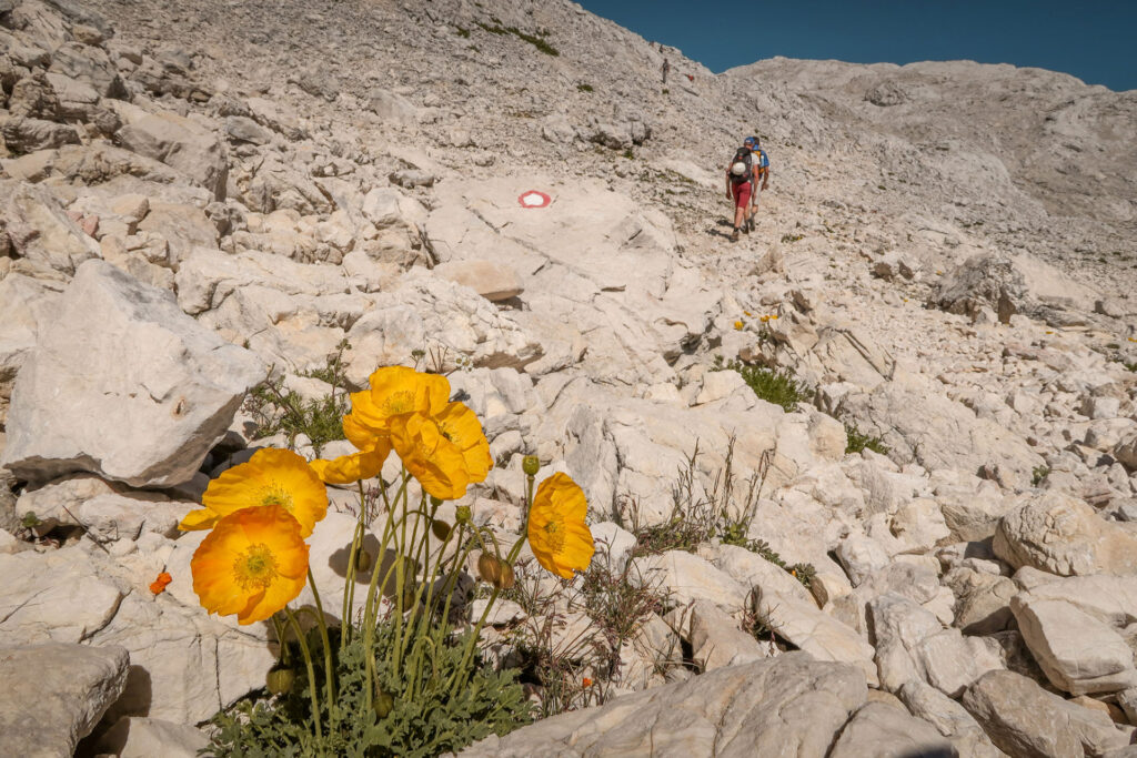
The trail from the mountain hut follows the former Italian mulatiera all the way to the turnoff for Triglav, where the via ferrata soon begins. This ferrata leads us to the summit of Triglav at 2864 m. On a clear day, the view opens all the way to the Slovenian sea. The descent follows the classic route, descending along the ridge to Mali Triglav at 2725 m, where the path splits to Dom Planika at 2401 m. From Planika, there is an easier descent to Vodnikov dom at 1817 m.
4. DAY
Vodnikov dom 1817 m – Velo Polje 1680 m – Jezerski Preval 1980 m – Krstenica Alpine Meadow 1645 m – Blato Alpine Meadow 1150 m
From the mountain hut, we descend to Velo Polje at 1680 m, known for its livestock grazing and cheese production from early July to late August. From there, the trail leads towards Jezerski Preval, followed by a descent to Krstenica Alpine Meadow at 1645 m and further to Blato Alpine Meadow at 1150 m, where transportation awaits us.
- Starting altitude: 1817 m
- Highest point: 1945 m
- Destination altitude: 1150 m
- Altitude difference: 265 m
- Length: 9 km
- Time: 4-5 h.
All tours organized by us require prior registration.
At the following link, you can find all the details about the four-day trek.
The beautiful valley of the Seven Lakes
1. DAY
Dom Klementa Juga in Lepena 700 m – Dom pri Krnskih jezerih 1385 m – Krn 2245 m – Batognica 2164 m – below the summit above Peski 2100 m – Prehodci Pass 1639m – Za Lepočami 1630 m – Bogatinsko saddle 1804 m – Dom na Komni 1520 m.
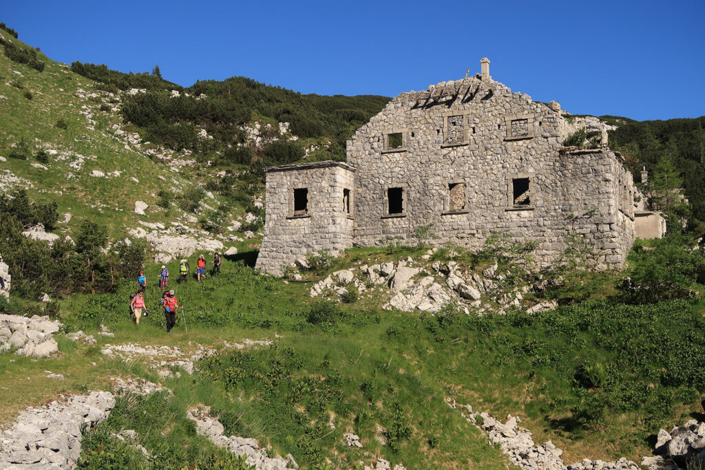
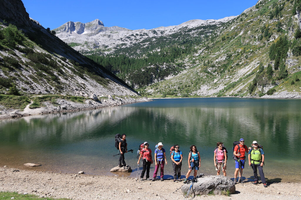
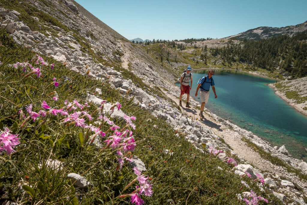
The path leads us from the secluded valley of Lepena to the Krn Lakes Mountain Hut. From there, we continue to the largest mountain lake - Lake Krn (300 m long, 150 m wide, and 18 m deep). There, the view stops at the northern wall of Mount Krn. The path leads us below it to the saddle between Krn and Batognica at 2058 m, and from there, right along the ridge to the summit. Climbing Batognica is a climb to the mountain of horror during the time of the Soča Front. The mountain was mined underground by the Austro-Hungarian army, and an Italian tunnel was also found because the Italians also wanted to mine the Austro-Hungarian positions, but the Austro-Hungarian soldiers beat them to it and mined half of the mountain. Numerous craters are still visible today as a result. From Batognica, we will descend to the Prehodci Pass at 1639 m, from there a bit lower to the old abandoned Italian barracks in the place below Lepočami at 1620m, which served as border control between the two wars. Then follows a climb to the Bogatinsko saddle 1084 m, where the border between Italy and the Kingdom of Yugoslavia ran between 1920 and 1945. At the end, there is a gentle descent along the mule track to the Dom na Komni at 1520 m.
- Starting altitude: 700 m
- Highest point: 2245 m
- Destination altitude: 1520 m
- Altitude difference: 1845 m
- Length: 25 km
- Time: 10-13 h.
2. DAY
Dom na Komni 1520 m – Lopučnica Valley 1550 m – Koča pri Triglavskih jezerih 1685 m – Hribarice 2358 m – Koča na Doliču 2151 m.
On this day, we will be amazed by the beauty of the longest high-mountain valley in the Julian Alps, a valley where the Triglav National Park was declared in 1961. Due to its geological and biological diversity, the alpine conservation park was declared here as early as 1934, laying the foundation for today's TNP. The trail gently ascends from Dom na Komni along the Triglavski smučarski magistrala to the Kalu pasture, and from there slowly descends into the Lopučnica valley at 1550 m. This is followed by a climb to the hut near the Triglav Lakes. Before we reach the hut, we are greeted by the first view of the 5th and 6th - the double Triglav Lake. In the middle of the valley is the 4th lake - Ledvička, which is also the largest. Before the ascent to Hribarice at 2385 m, we also catch a glimpse of the 3rd lake - Green Lake and the 2nd lake - Brown Lake. Once we reach the Hribarice saddle at 2385 m, there is only a descent left to the Koča na Doliču at 2151 m.
- Starting altitude: 1520 m
- Highest point: 2385 m
- Destination altitude: 2151 m
- Altitude difference: 965 m
- Length: 18 km
- Time: 9-10 h.
All tours organized by us require prior registration.
You can find all the details about the two-day exploration of the Julian Alps at the following link.
Where can you find us?
Our contact
For more information, you can also call us or send us an email.
RELATED ACTIVITIES
Check out the rest of the offer